Property Listing: Status: Active (Listed on: 08/21/2024)
In City Limits, 5 minutes to Grocery, Sanders Arizona, Lot 235
Listing ID:
24937
Price:
$5,200
1.15 Acres +/-


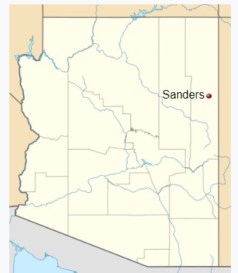
General Location:
Five minutes south of I-40 Freeway
Address:
235 Blossom Lane
City, State Zip:
Sanders, AZ 86512
County:
Apache County
MLS #:
none
Listing ID:
24937
Description:
1.15 acres Within City Limits
Next door to Sanders Valley High School
1) $5,200 plus $400 closing cost
2) Utilities Nearby
3) Just five minutes to Basha’s Grocery Store
4) Undeveloped Homesite
5) No HOA
6) No neighbors
7) Quiet and peaceful open spaces
8) Conveyed by Warranty Deed (through a title company)
9) A second 1.15 acre parcel, Lot 237, is also available
** DETAILS **
• Parcel Number: 207-26-235
• Zoning: Agricultural General
• Elevation: 5,865 ft.
• Terrain: Level, sloping
• Road Access: The subdivision road is undeveloped,
the closest dirt road is one parcel north
• Floodzone: “Zone D” (Undetermined Risk), from FEMA map
• Sanders Unified School District: Elementary, Middle, and High School
• Size: 1.15 acres, approx. 160 x 301 = 48,160 SF
• Property Tax: Only $6 per year - Taxes are paid and up-to-date
** UTILITIES **
1) Water: Navajo Tribal Utility Authority, 800-528-5011. Contact to confirm serviceability. This lot is on the Coconino Aquifer.
2) Electric: Navajo Tribal Utility Authority, 800-528-5011. Contact to confirm serviceability.
3) Sewer: Septic tank after your percolation test is completed. Contact Apache County Environmental Services, (928) 337-7607.
4) Propane: Delivery service
5) Natural Gas: None
6) Internet: Contact Choice Broadband, Starlink, or other company
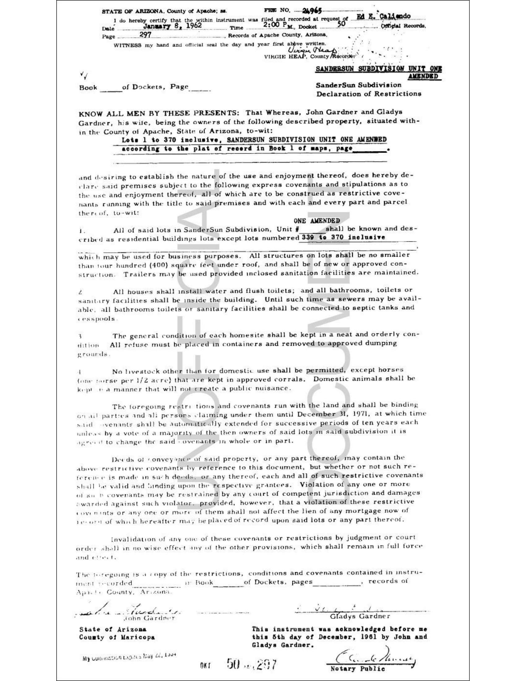
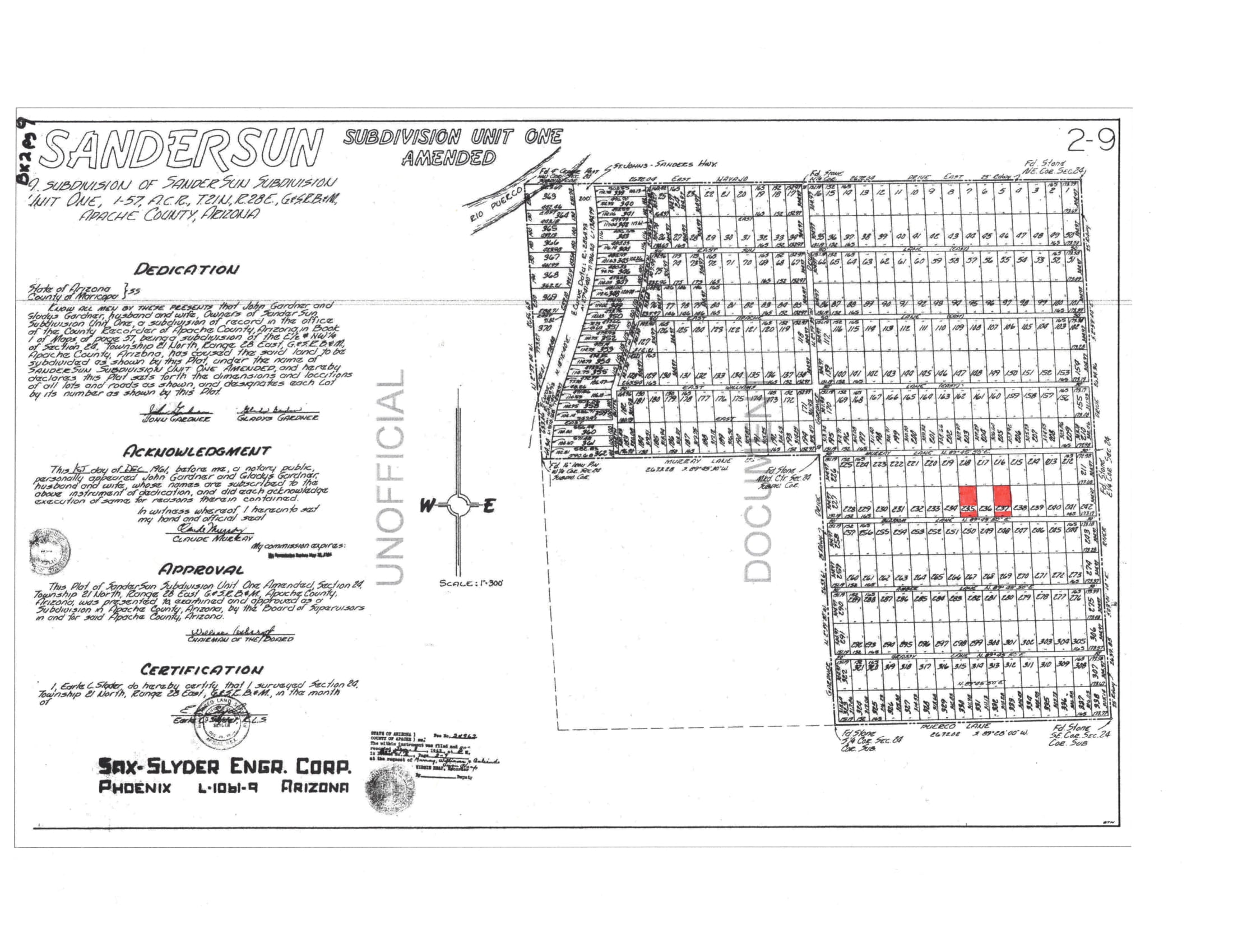
** SUBDIVISION PLAT MAP **
“Documents” section - Scroll down past the Google map below to view the original Plat Map and restrictions from year 1962
** LEGAL DESCRIPTION **
“Lot 235 of Arizona Park Estates Unit One, according to the plat of record in the office of the County Recorder of Apache County, Arizona, recorded in Book 3, Maps. Except all coal and other minerals as reserved by the United States of America.”
** NATIVE VEGETATION **
Juniper and Piñon Trees, Brittlebush Flowers, Sagebrush, Prairie Grass
** ALLOWED PER ZONING **
• One single-family dwelling/modular home/mobile home
• Building height limited to two stories.
Contact the Apache County Building Safety Department.
• RV (recreational vehicle) camping up to 30 days in a row (every quarter).
• If RV is over 30 days, must first have a septic tank installed.
• Horses, cattle, sheep, goats, hogs, poultry
** EXCELLENT LOCATION **
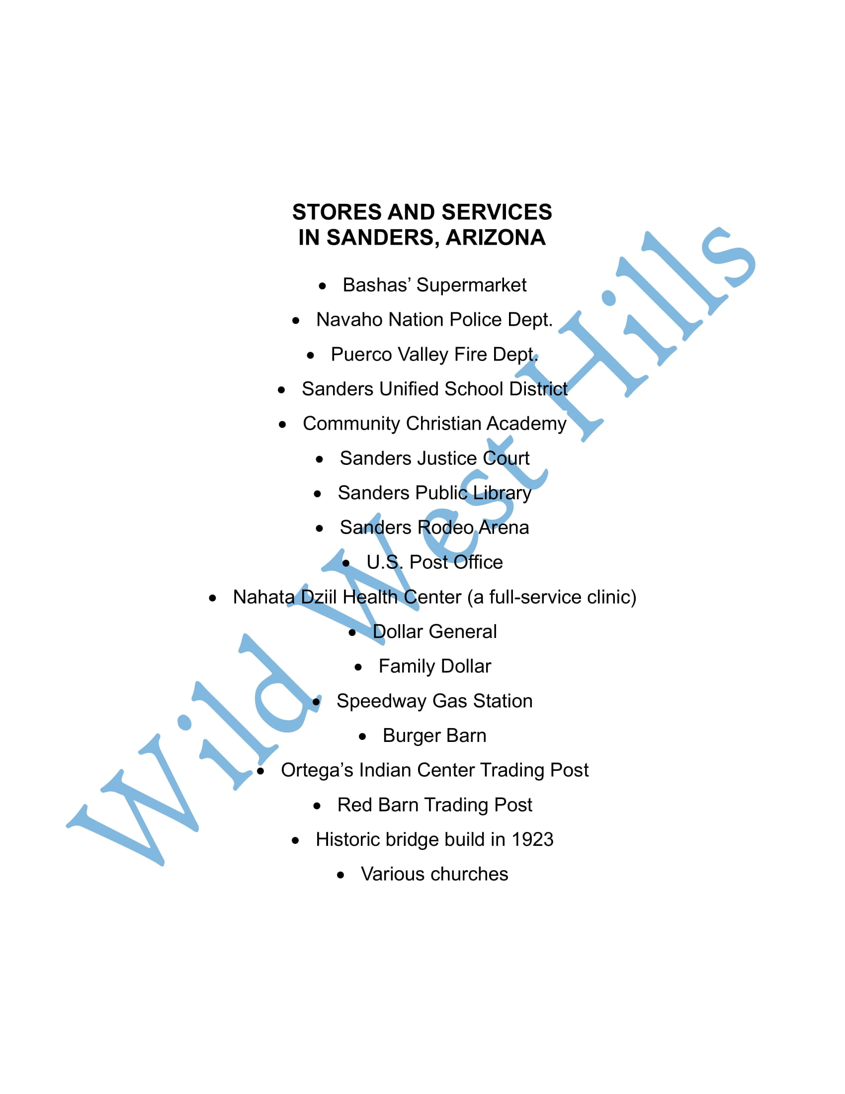
• Within Sanders city limits - close to stores, medical clinic, freeway, etc.
• 1/2 mile from Historic U.S. Route 66, “The Mother Road”
• 1/2 mile from Interstate Highway 40 (I-40)
• 1/4 mile from U.S. Highway 191
• GPS Coordinates – Latitude and Longitude:
(Lot 235) 35.20163, -109.31851
(Lot 237) 35.20193, -109.31770
• Nearest Intersection is Dine’h Tah Boulevard and Route 7238
Web Link
** CONTACT US **
Email: WildWestHills@GMail.com
Message Phone: (520) 280-0041
***********
Seller assumes no liability for any possible liens, ability to develop the land, encumbrances or easements, recorded or not recorded. Contact the Apache County Building Department directly with any specific questions. All information provided here is to the best of our knowledge. No warranties are stated or implied. Land is being sold as is. Buyer is responsible for doing all due diligence and verifying accessibility, zoning, utilities, buildability, and all other pertinent information contained herein prior to purchase.
Next door to Sanders Valley High School
1) $5,200 plus $400 closing cost
2) Utilities Nearby
3) Just five minutes to Basha’s Grocery Store
4) Undeveloped Homesite
5) No HOA
6) No neighbors
7) Quiet and peaceful open spaces
8) Conveyed by Warranty Deed (through a title company)
9) A second 1.15 acre parcel, Lot 237, is also available
** DETAILS **
• Parcel Number: 207-26-235
• Zoning: Agricultural General
• Elevation: 5,865 ft.
• Terrain: Level, sloping
• Road Access: The subdivision road is undeveloped,
the closest dirt road is one parcel north
• Floodzone: “Zone D” (Undetermined Risk), from FEMA map
• Sanders Unified School District: Elementary, Middle, and High School
• Size: 1.15 acres, approx. 160 x 301 = 48,160 SF
• Property Tax: Only $6 per year - Taxes are paid and up-to-date
** UTILITIES **
1) Water: Navajo Tribal Utility Authority, 800-528-5011. Contact to confirm serviceability. This lot is on the Coconino Aquifer.
2) Electric: Navajo Tribal Utility Authority, 800-528-5011. Contact to confirm serviceability.
3) Sewer: Septic tank after your percolation test is completed. Contact Apache County Environmental Services, (928) 337-7607.
4) Propane: Delivery service
5) Natural Gas: None
6) Internet: Contact Choice Broadband, Starlink, or other company
** SUBDIVISION PLAT MAP **
“Documents” section - Scroll down past the Google map below to view the original Plat Map and restrictions from year 1962
** LEGAL DESCRIPTION **
“Lot 235 of Arizona Park Estates Unit One, according to the plat of record in the office of the County Recorder of Apache County, Arizona, recorded in Book 3, Maps. Except all coal and other minerals as reserved by the United States of America.”
** NATIVE VEGETATION **
Juniper and Piñon Trees, Brittlebush Flowers, Sagebrush, Prairie Grass
** ALLOWED PER ZONING **
• One single-family dwelling/modular home/mobile home
• Building height limited to two stories.
Contact the Apache County Building Safety Department.
• RV (recreational vehicle) camping up to 30 days in a row (every quarter).
• If RV is over 30 days, must first have a septic tank installed.
• Horses, cattle, sheep, goats, hogs, poultry
** EXCELLENT LOCATION **
• Within Sanders city limits - close to stores, medical clinic, freeway, etc.
• 1/2 mile from Historic U.S. Route 66, “The Mother Road”
• 1/2 mile from Interstate Highway 40 (I-40)
• 1/4 mile from U.S. Highway 191
• GPS Coordinates – Latitude and Longitude:
(Lot 235) 35.20163, -109.31851
(Lot 237) 35.20193, -109.31770
• Nearest Intersection is Dine’h Tah Boulevard and Route 7238
Web Link
** CONTACT US **
Email: WildWestHills@GMail.com
Message Phone: (520) 280-0041
***********
Seller assumes no liability for any possible liens, ability to develop the land, encumbrances or easements, recorded or not recorded. Contact the Apache County Building Department directly with any specific questions. All information provided here is to the best of our knowledge. No warranties are stated or implied. Land is being sold as is. Buyer is responsible for doing all due diligence and verifying accessibility, zoning, utilities, buildability, and all other pertinent information contained herein prior to purchase.
https://www.youtube.com/watch?v=tNmrVKp843M
Map:
35.2016, -109.319(Click the marker to open in Google Maps.)