Property Listing: Status: Active (Listed on: 02/28/2023)
1.52 Acre Residential Property Minutes from Angel Fire Resort
Listing ID:
18535
Price:
$45,000
1.52 Acres +/-


General Location:
Angel Fire, New Mexico
City, State Zip:
Angel Fire, NM 88710
County:
Colfax County
MLS #:
Listing ID:
18535
Description:
1.52 Acres in Colfax County, New Mexico, in Angel Fire, with utilities at the lot line, year-round access, and a short drive from Angel Fire Resort!
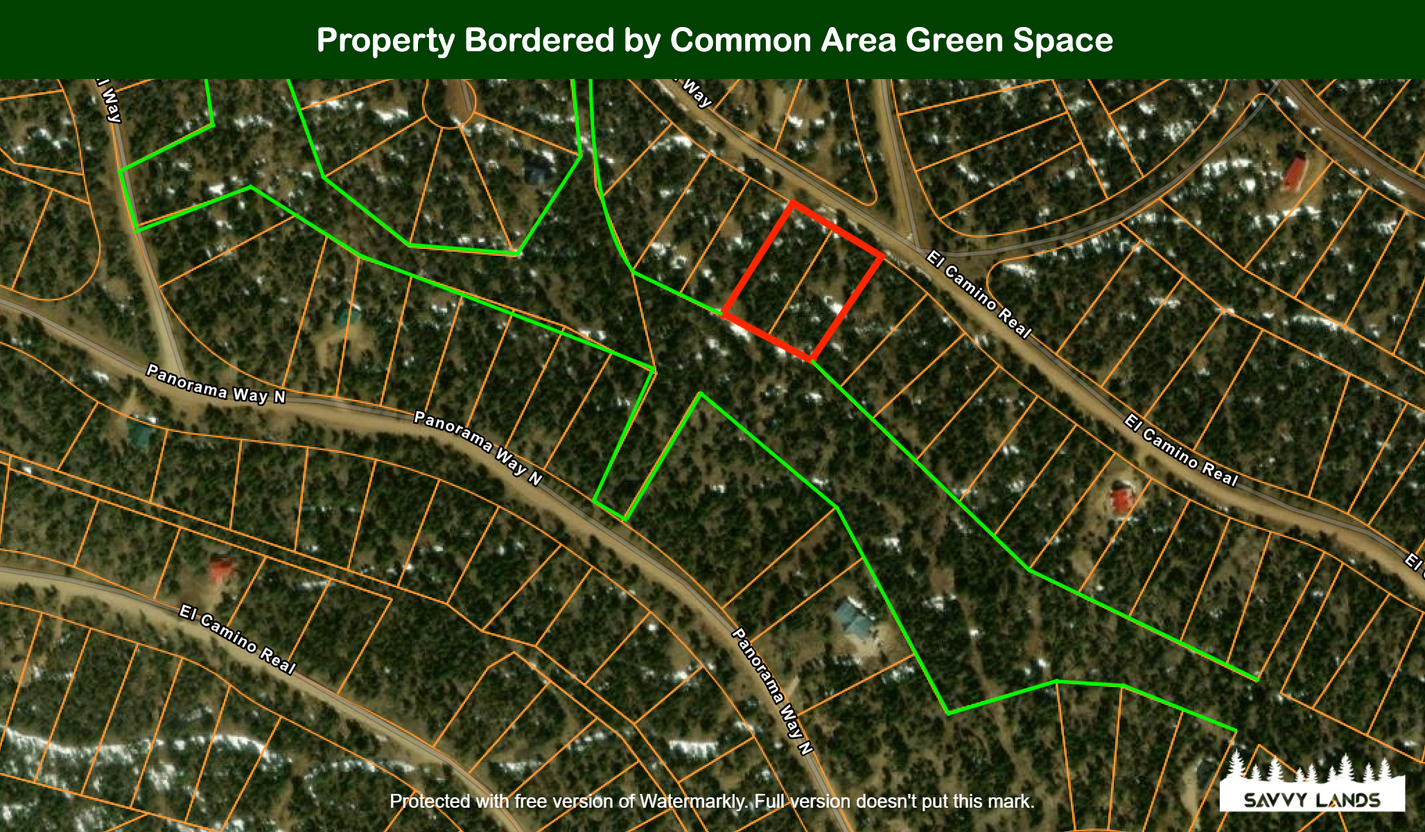
The property is also bordered by common area/green space along its back border, adding more privacy to your new vacation home!
NOTE: This property is actually TWO properties! Buy BOTH for a discounted price, or buy one at full price. Each individual property is slightly more than 0.75 acres in size - see details below!
DISCOUNTED CASH PRICE:
Price for ONE Property: $25,000.00
Price for BOTH Properties: $45,000.00
==============================================
PROPERTY DETAILS:
State: New Mexico
County: Colfax
City: Angel Fire
Postal Code: 87710
Size (Acres): Lot #1433 = 0.7685ac; Lot #1434 = 0.7535ac; Total Size = 1.522ac
Size (Square Feet): Lot #1433 = 33,475sqft; Lot #1434 = 32,822sqft; Total Size = 66,297sqft (there are 43,560 sqft in 1 acre)
Property ID #: Lot #1434: 1-089-149-510-052 (R005704); Lot #1434: 1-089-149-502-057 (R008174)
Legal Description: Angel Fire Chalets #2 - 3B Lot: 1433 & 1434
Property Address: The property does not have a street address as there is no home currently on the property.
Street Name: Google maps shows the street name as "Cheerful Way", but the street name is actually Royal Avenue.
Closest Cross Street Name: El Camino Real
Zoning: Residential
Power: Available Throughout Subdivision, supplied by Kit Carson Electric Cooperative
Water: Available Throughout Subdivision, supplied by Angel Fire Village
Sewer: Septic would need to be installed on the property.
Cable / Internet: In the area
Roads: Gravel Roads in subdivision
Survey: None. Property location determined by subdivision maps of Angel Fire.
Property Taxes (Annual): Lot 1433: $103.52 in 2022; Lot 1434: $101.48 in 2022
Property Back Taxes: None
School District Name: Cimarron Municipal Schools
School District Taxes (Annual): N/A
School District Back Taxes: N/A
Association Name: Association of Angel Fire Property Owners
Association Fees (Annual): $1,455.00 in 2022, per property. -- If you choose to purchase both properties, Buyer to verify there is potential to combine both lots for Association and lot line purposes. AAFPO membership confirmed via phone call with us on Feb. 22 2023 that these properties are not deed restricted and can be combined. We encourage you to do your own due diligence and research. Call the AAFPO Membership Office at 575-377-4260 to ask them to verify and/or ask any questions you have regarding AAFPO membership.
Association Back Fees: None
Other Association Info: All property owners in Angel Fire are automatically enrolled in the AAFPO. AAFPO oversees all upkeep/maintenance in Angel Fire Resort.
Restrictions: See CCR documents
Time Limit to Build: Six Months
General Elevation (Feet): 9,800 feet
General Terrain: Very-Gently Sloped - approximately a 27-foot decline across approximately 325 feet from front of property to back of property
Flood Zone: No
Directions:
Note: While the route on Google Maps is accurate, the road names are not. Please make sure you are familiar with the route to the property. We suggest making yourself familiar with the Google Street and Google Satellite views.
1.) From CR434 in Angel Fire, turn east on N Angel Fire
2.) After 0.6 miles, turn right (south) on to Vail Ave. Vail Ave becomes El Camino Real.
3.) Follow El Camino Real for about 4.5 miles. Once El Camino Real switches to Royal Ave, you're at the property. (on the left)
1.) From CR434 in Angel Fire, turn east on N Angel Fire
2.) After 0.6 miles, turn right (south) on to Vail Ave. Vail Ave becomes El Camino Real.
3.) Follow El Camino Real for about 4.5 miles. Once El Camino Real switches to Royal Ave, you're at the property. (on the left)
Map:
36.3651, -105.257(Click the marker to open in Google Maps.)
|
|||||||||||||||||||||||||||||||||||||||||